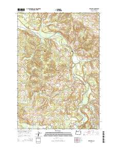
2014 Map of Pittsburg
USGS Topo · Published 2014About this map
Pittsburg serves as the focal point for this survey of Columbia County’s interior, where the Nehalem River winds through the deep Nehalem Valley. The landscape is defined by its industrial timber infrastructure, evidenced by an extensive network of mainline logging roads including the Crooked Creek Mainline, Kauppi Mainline, and Barnhardt Mnln. These routes traverse the high ridges between drainage basins like Battle Creek and Crooked Creek, reflecting the area's history of forest management and resource extraction. Significant water features such as Hawkins Lake and Lindsay Lake sit alongside smaller landmarks like O'Black Pond. The intersection of the Scappoose Vernonia Hwy and the Nehalem River at Pittsburg highlights the traditional transportation corridor that connects this timber country to the larger valley systems.
Find a feature on this map
46 named features on this map. Tap any name to fly to it.
Don’t see what you’re looking for? This feature index may not catch every label — zoom into the map to look around manually.
Map Details
Editions of this 2014 Pittsburg Map
This is the sole edition of this map. No revisions or reprints were ever made.
Other maps of this area

1919 · Mayger
USGS Topo · 1:62,500

1940 · Vernonia
USGS Topo · 1:62,500

1941 · Keasey
USGS Topo · 1:62,500

1941 · Clatskanie
USGS Topo · 1:62,500

1941 · Cathlamet
USGS Topo · 1:62,500

1943 · Vernonia
USGS Topo · 1:62,500

1943 · Keasey
USGS Topo · 1:62,500

1948 · Vancouver
USGS Topo · 1:250,000

1950 · Vancouver
USGS Topo · 1:250,000

1950 · Vancouver
USGS Topo · 1:250,000