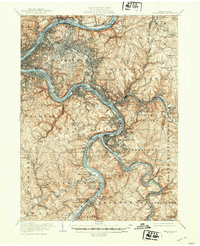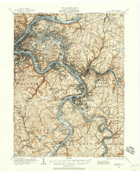
1904 Map of Pittsburgh
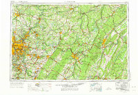
USGS Topo · Published 1957About this map
The Monongahela River, Allegheny River, and Youghiogheny River converge within this industrial landscape at the dawn of the twentieth century, illustrating a region defined by its water-and-rail topography. The Pennsylvania RR and numerous specialized lines like the Union RR lace through the river valleys, connecting steel centers such as Braddock, Homestead, and Swissvale. Beyond the dense urban core of Pittsburgh, the map reveals the era's transition from city to rural township, featuring large green spaces like Highland Park and the expansive Homewood Cem.
Find a feature on this map
149 named features on this map. Tap any name to fly to it.
Don’t see what you’re looking for? This feature index may not catch every label — zoom into the map to look around manually.
Map Details
Editions of this 1904 Pittsburgh Map
2 editions found

Historical Maps of Pittsburgh Through Time
7 maps found