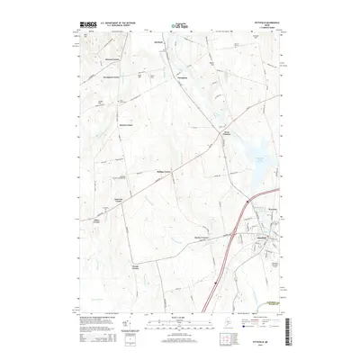
2014 Map of Pittsfield
USGS Topo · Published 2014About this map
The Sebasticook River flows through the heart of this Central Maine landscape, defining the industrial and agricultural character of Pittsfield and its surrounding rural hamlets. By the early 21st century, the area maintained a network of historic crossroads settlements such as Manson Corner, Thompson Corner, and Emerson Corner, which speak to the region's 19th-century farming roots. The concentration of cemeteries, including Pine Grove Cem in Hartland and Warren Hill Cem, provides a significant resource for genealogical research into the families that established these Somerset County communities.
Find a feature on this map
95 named features on this map. Tap any name to fly to it.
Don’t see what you’re looking for? This feature index may not catch every label — zoom into the map to look around manually.
Map Details
Editions of this 2014 Pittsfield Map
This is the sole edition of this map. No revisions or reprints were ever made.
Other maps of this area

1892 · Waterville
USGS Topo · 1:62,500

1913 · Skowhegan
USGS Topo · 1:62,500

1926 · Burnham
USGS Topo · 1:62,500

1930 · Pittsfield
USGS Topo · 1:48,000

1932 · Pittsfield
USGS Topo · 1:62,500

1933 · Pittsfield
USGS Topo · 1:62,500

1943 · Waterville
USGS Topo · 1:62,500

1948 · Bangor
USGS Topo · 1:250,000

1955 · Pittsfield
USGS Topo · 1:62,500

1955 · Skowhegan
USGS Topo · 1:62,500