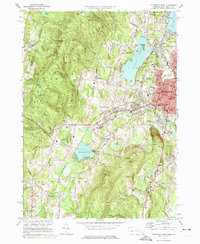
1973 Map of Pittsfield West
USGS Topo · Published 1975About this map
The western edge of Pittsfield and the high ridges of the Taconic Range define this landscape during the mid-1970s. Urban expansion meets the wilder Berkshire terrain near Onota Lake and Pontoosuc Lake, where numerous summer camps like Camp Witawentin and Camp Russell dot the shorelines. The map documents significant local landmarks including the Pittsfield Municipal Airport and the winter recreation hub at Bousquet Ski Area.
Find a feature on this map
92 named features on this map. Tap any name to fly to it.
Don’t see what you’re looking for? This feature index may not catch every label — zoom into the map to look around manually.
Map Details
Editions of this 1973 Pittsfield West Map
4 editions found
Other maps of this area

1886 · Greylock
USGS Topo · 1:62,500

1886 · Becket
USGS Topo · 1:62,500

1888 · Becket
USGS Topo · 1:62,500

1888 · Berlin
USGS Topo · 1:62,500

1888 · Pittsfield
USGS Topo · 1:62,500

1890 · Pittsfield
USGS Topo · 1:62,500

1890 · Berlin
USGS Topo · 1:62,500

1891 · Greylock
USGS Topo · 1:62,500

1893 · Becket
USGS Topo · 1:62,500

1893 · Greylock
USGS Topo · 1:62,500