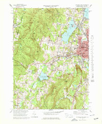
1973 Map of Pittsfield West
USGS Topo · Published 1978About this map
Onota Lake and the western edge of Pittsfield anchor this Berkshire County landscape during a period of mid-century growth. The map illustrates a complex geography where industrial history meets natural recreation, featuring the extensive grounds of Pittsfield Cemetery and the Naval Reserve Center near the city core. To the west, the terrain rises into the Taconic Range, crossing the New York Massachusetts state line and encompassing the historical site of Shaker Village and the high elevations of Shaker Mtn.
Find a feature on this map
79 named features on this map. Tap any name to fly to it.
Don’t see what you’re looking for? This feature index may not catch every label — zoom into the map to look around manually.
Map Details
Editions of this 1973 Pittsfield West Map
4 editions found
Other maps of this area

1886 · Greylock
USGS Topo · 1:62,500

1886 · Becket
USGS Topo · 1:62,500

1888 · Becket
USGS Topo · 1:62,500

1888 · Berlin
USGS Topo · 1:62,500

1888 · Pittsfield
USGS Topo · 1:62,500

1890 · Pittsfield
USGS Topo · 1:62,500

1890 · Berlin
USGS Topo · 1:62,500

1891 · Greylock
USGS Topo · 1:62,500

1893 · Becket
USGS Topo · 1:62,500

1893 · Greylock
USGS Topo · 1:62,500