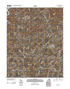
2011 Map of Pittsville
USGS Topo · Published 2011About this map
Pittsville and the surrounding crossroads of Pittsylvania County represent a rural Virginia landscape defined by long-standing family settlements and the complex drainage of the Roanoke River watershed. Small communities like Redeye, Toshes, and Climax are connected by a network of local routes including Pittsville Rd and Anderson Mill Rd, reflecting the area's agricultural and milling history. The terrain is marked by significant hydrological features such as Whitethorn Creek and Cherrystone Creek, while Farmers Mountain rises as a prominent landmark in the northeast. This 2011 survey captures the distribution of rural homesteads and named locales like Walkers Well and Whittles before the continued modernization of the Piedmont region. Local history is etched into the road names themselves, with Tucks Cemetery Rd pointing toward genealogical sites, and Shelhorse Dam indicating early water management in the creek systems.
Find a feature on this map
46 named features on this map. Tap any name to fly to it.
Don’t see what you’re looking for? This feature index may not catch every label — zoom into the map to look around manually.
Map Details
Editions of this 2011 Pittsville Map
This is the sole edition of this map. No revisions or reprints were ever made.
Other maps of this area

1890 · Roanoke
USGS Topo · 1:125,000

1891 · Roanoke
USGS Topo · 1:125,000

1892 · Lynchburg
USGS Topo · 1:125,000

1921 · Chatham
USGS Topo · 1:48,000

1922 · Callands
USGS Topo · 1:48,000

1923 · Chatham
USGS Topo · 1:62,500

1924 · Callands
USGS Topo · 1:62,500

1944 · Callands
USGS Topo · 1:62,500

1947 · Roanoke
USGS Topo · 1:250,000

1951 · Moneta
USGS Topo · 1:62,500