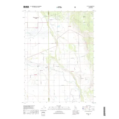
2018 Map of Pittville
USGS Topo · Published 2018About this map
Pittville serves as the central settlement on this northeastern California landscape, situated where the Pit River winds through a complex valley system. The area is defined by its water management and diverse terrain, featuring several irrigation and storage bodies such as Toll House Reservoir, Hardin Reservoir, and Crum Reservoir. To the west, the boundary of the Shasta National Forest meets the valley floor, while the Big Valley Mountains rise to the northeast. A network of rural roads, including Old Toll Rd and Pittville Rd, traces the historic movement of people and goods across the Shasta and Lassen County line. The presence of Hot Springs and named points like Taylor Knob and Sleepy Hollow highlights the unique geological and cultural markers of this high-elevation basin, emphasizing its character as a working ranching and forestry landscape.
Find a feature on this map
50 named features on this map. Tap any name to fly to it.
Don’t see what you’re looking for? This feature index may not catch every label — zoom into the map to look around manually.
Map Details
Editions of this 2018 Pittville Map
This is the sole edition of this map. No revisions or reprints were ever made.
Other maps of this area

1886 · Lassen Peak
USGS Topo · 1:250,000

1886 · Modoc Lava Bed
USGS Topo · 1:250,000

1892 · Modoc Lava-Bed
USGS Topo · 1:250,000

1892 · Lassen Peak
USGS Topo · 1:250,000

1894 · Lassen Peak
USGS Topo · 1:250,000

1939 · Halls Flat
USGS Topo · 1:125,000

1954 · Alturas
USGS Topo · 1:250,000

1955 · Westwood
USGS Topo · 1:250,000

1957 · Little Valley
USGS Topo · 1:62,500

1957 · Jellico
USGS Topo · 1:62,500