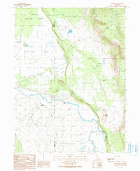
1990 Map of Pittville
USGS Topo · Published 1990About this map
Pittville serves as the focal point of this rural California landscape, situated along the northern banks of the Pit River. The terrain transitions from the broad agricultural expanse of the Fall River Valley in the west to the higher, forested elevations of the Shasta National Forest in the north. The water management and natural hydrology of the area are well-documented, featuring the Lee Drainage Canal and the cascade at Young Falls, alongside multiple reservoirs such as Crum Reservoir and Toll House Reservoir.
Find a feature on this map
21 named features on this map. Tap any name to fly to it.
Don’t see what you’re looking for? This feature index may not catch every label — zoom into the map to look around manually.
Map Details
Editions of this 1990 Pittville Map
This is the sole edition of this map. No revisions or reprints were ever made.
Other maps of this area

1886 · Lassen Peak
USGS Topo · 1:250,000

1886 · Modoc Lava Bed
USGS Topo · 1:250,000

1892 · Modoc Lava-Bed
USGS Topo · 1:250,000

1892 · Lassen Peak
USGS Topo · 1:250,000

1894 · Lassen Peak
USGS Topo · 1:250,000

1939 · Halls Flat
USGS Topo · 1:125,000

1954 · Alturas
USGS Topo · 1:250,000

1955 · Westwood
USGS Topo · 1:250,000

1957 · Little Valley
USGS Topo · 1:62,500

1957 · Jellico
USGS Topo · 1:62,500