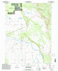
1995 Map of Pittville
USGS Topo · Published 1998About this map
The Pit River and its meandering tributaries dominate the landscape of the northern Fall River Valley as it appeared in the mid-1990s. The settlement of Pittville sits near the river's edge, marked by a Gaging Station and adjacent irrigation infrastructure like the Lee Ranch and various canals. This area, straddling the Shasta and Lassen county line, reveals a transition from the agricultural valley floor to the forested slopes of the Shasta National Forest.
Find a feature on this map
33 named features on this map. Tap any name to fly to it.
Don’t see what you’re looking for? This feature index may not catch every label — zoom into the map to look around manually.
Map Details
Editions of this 1995 Pittville Map
This is the sole edition of this map. No revisions or reprints were ever made.
Other maps of this area

1886 · Lassen Peak
USGS Topo · 1:250,000

1886 · Modoc Lava Bed
USGS Topo · 1:250,000

1892 · Modoc Lava-Bed
USGS Topo · 1:250,000

1892 · Lassen Peak
USGS Topo · 1:250,000

1894 · Lassen Peak
USGS Topo · 1:250,000

1939 · Halls Flat
USGS Topo · 1:125,000

1954 · Alturas
USGS Topo · 1:250,000

1955 · Westwood
USGS Topo · 1:250,000

1957 · Little Valley
USGS Topo · 1:62,500

1957 · Jellico
USGS Topo · 1:62,500