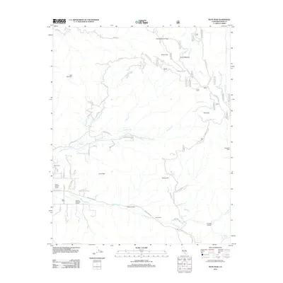
2012 Map of Piute Peak
USGS Topo · Published 2012About this map
Piute Peak dominates the eastern high ground of this Kern County landscape, where the Sierra Nevada terrain is defined by a network of seasonal creeks and remote ranching outposts. This 2012 survey documents the persistent presence of legacy landholdings such as Walser Ranch, Mills Ranch, and Cannon Ranch, alongside specialized aviation infrastructure like the Flying S Ranch Airport and Shadow Mountain Airstrip. The map traces the winding course of Rancheria Cr and Thompson Cr as they cut through significant geological formations including Cholly Canyon and LocoBill Canyon.
Find a feature on this map
76 named features on this map. Tap any name to fly to it.
Don’t see what you’re looking for? This feature index may not catch every label — zoom into the map to look around manually.
Map Details
Editions of this 2012 Piute Peak Map
This is the sole edition of this map. No revisions or reprints were ever made.
Other maps of this area

1906 · Kernville
USGS Topo · 1:125,000

1908 · Kernville
USGS Topo · 1:125,000

1914 · Caliente
USGS Topo · 1:125,000

1915 · Mojave
USGS Topo · 1:125,000

1920 · Delonagha
USGS Topo · 1:62,500

1926 · Glennville
USGS Topo · 1:62,500

1936 · Tobias Peak
USGS Topo · 1:125,000

1943 · Emerald Mtn
USGS Topo · 1:62,500

1943 · Breckenridge Mountain
USGS Topo · 1:62,500

1943 · Tobias Peak
USGS Topo · 1:125,000