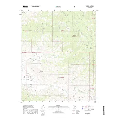
2018 Map of Piute Peak
USGS Topo · Published 2018About this map
Walker Basin serves as a central hub for this high-elevation landscape in Kern County, situated where the valley floor meets the steep rise of the Piute Mountains. The 2018 survey detail shows a network of local roads including Heritage Way and Walker Basin RD, supporting a scatter of ranching and aviation interest near the Flying S Ranch Airport. Much of the map's northern half is dominated by the Sequoia National Forest, reaching its highest points at Piute Peak and Brown Peak. The terrain is deeply incised by drainages like Rancheria Cr and Thompson Cr, with springs such as Thompson Spring and the Yates Hot Springs providing critical water sources in an otherwise dry, mountainous environment. This modern topographic record captures the transition from the private ranch lands of the basin to the protected federal forest lands of King Solomons Ridge.
Find a feature on this map
77 named features on this map. Tap any name to fly to it.
Don’t see what you’re looking for? This feature index may not catch every label — zoom into the map to look around manually.
Map Details
Editions of this 2018 Piute Peak Map
This is the sole edition of this map. No revisions or reprints were ever made.
Other maps of this area

1906 · Kernville
USGS Topo · 1:125,000

1908 · Kernville
USGS Topo · 1:125,000

1914 · Caliente
USGS Topo · 1:125,000

1915 · Mojave
USGS Topo · 1:125,000

1920 · Delonagha
USGS Topo · 1:62,500

1926 · Glennville
USGS Topo · 1:62,500

1936 · Tobias Peak
USGS Topo · 1:125,000

1943 · Emerald Mtn
USGS Topo · 1:62,500

1943 · Breckenridge Mountain
USGS Topo · 1:62,500

1943 · Tobias Peak
USGS Topo · 1:125,000