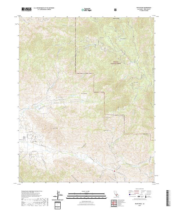
2021 Map of Piute Peak
USGS Topo · Published 2021About this map
Sequoia National Forest encompasses the high ridges and steep canyons of the southern Sierra Nevada range on this 2021 survey. The landscape is defined by massive granite features like Piute Peak and Johns Peak, along with the prominent King Solomons Ridge and Red Mtn. Human activity is concentrated in the southern valleys near Walker Basin, where a network of rural roads such as Redstone Ave and Ann Jeanette St serve ranching properties and the Flying S Ranch Airport.
Find a feature on this map
75 named features on this map. Tap any name to fly to it.
Don’t see what you’re looking for? This feature index may not catch every label — zoom into the map to look around manually.
Map Details
Editions of this 2021 Piute Peak Map
This is the sole edition of this map. No revisions or reprints were ever made.
Other maps of this area

1906 · Kernville
USGS Topo · 1:125,000

1908 · Kernville
USGS Topo · 1:125,000

1914 · Caliente
USGS Topo · 1:125,000

1915 · Mojave
USGS Topo · 1:125,000

1920 · Delonagha
USGS Topo · 1:62,500

1926 · Glennville
USGS Topo · 1:62,500

1936 · Tobias Peak
USGS Topo · 1:125,000

1943 · Emerald Mtn
USGS Topo · 1:62,500

1943 · Breckenridge Mountain
USGS Topo · 1:62,500

1943 · Tobias Peak
USGS Topo · 1:125,000