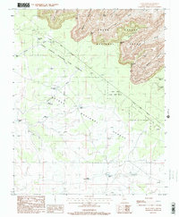
1988 Map of Piute Point
USGS Topo · Published 1988About this map
Pollux Temple and Diana Temple rise as prominent geological formations in this section of the Arizona landscape, where the plateau meets the northern reaches of the Grand Canyon National Park. The land is defined by a series of dramatic drainages including Turquoise Canyon, Sapphire Canyon, and Agate Canyon, which carry runoff toward the Colorado River. The southern portion of the map transitions into the Kaibab National Forest and the Grand Canyon National Game Preserve, where the terrain becomes a network of washes and livestock water sources. Numerous named tanks, such as Sam Moore Tank, Little Rain Tank, and Ike Smith Tank, indicate the historical importance of water management for grazing in this arid environment. The presence of the Tonto Trail and the Salt River Meridian highlights the intersection of early transit routes and formal land surveying in the late twentieth century.
Find a feature on this map
34 named features on this map. Tap any name to fly to it.
Don’t see what you’re looking for? This feature index may not catch every label — zoom into the map to look around manually.
Map Details
Editions of this 1988 Piute Point Map
2 editions found
Other maps of this area

1886 · Chino
USGS Topo · 1:250,000

1886 · Kaibab
USGS Topo · 1:250,000

1891 · Chino
USGS Topo · 1:250,000

1903 · Bright Angel
USGS Topo · 1:48,000

1906 · Bright Angel
USGS Topo · 1:48,000

1948 · Williams
USGS Topo · 1:250,000

1953 · Grand Canyon
USGS Topo · 1:250,000

1954 · Williams
USGS Topo · 1:250,000

1956 · Williams
USGS Topo · 1:250,000

1957 · Grand Canyon
USGS Topo · 1:250,000