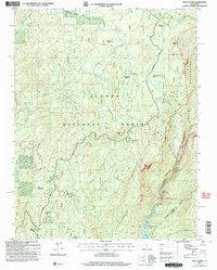
2004 Map of Piyau Dome
USGS Topo · Published 2007About this map
Sierra National Forest lands dominate this high-country survey, centered on the diverse meadow systems and granite formations of the upper San Joaquin watershed. The landscape is a mix of protected wilderness and forest management facilities, anchored by the Minarets Work Center and the Heliport near Arnold Meadow. Seasonal use and local history are reflected in sites like Topping Cow Camp and the Jackass Rock Organization Camp.
Find a feature on this map
41 named features on this map. Tap any name to fly to it.
Don’t see what you’re looking for? This feature index may not catch every label — zoom into the map to look around manually.
Map Details
Editions of this 2004 Piyau Dome Map
This is the sole edition of this map. No revisions or reprints were ever made.
Other maps of this area

1901 · Mt. Lyell
USGS Topo · 1:125,000

1904 · Kaiser
USGS Topo · 1:125,000

1947 · Mariposa
USGS Topo · 1:250,000

1948 · Mariposa
USGS Topo · 1:250,000

1953 · Merced Peak
USGS Topo · 1:62,500

1953 · Devils Postpile
USGS Topo · 1:62,500

1953 · Shuteye Peak
USGS Topo · 1:62,500

1953 · Kaiser Peak
USGS Topo · 1:62,500

1957 · Mariposa
USGS Topo · 1:250,000

1963 · Mariposa
USGS Topo · 1:250,000