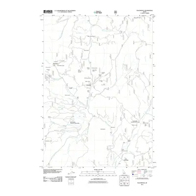
2011 Map of Placerville
USGS Topo · Published 2011About this map
The Boise Basin reveals a landscape defined by its deep mining heritage, centered on the historic settlements of Placerville and Quartzburg. This area, once a focal point of 19th-century gold fever, retains numerous named mining sites such as the Gold Hill Mine, Mineral Hill Mine, and Iowa Mine. The geography is characterized by a dense network of gulches—including Confederate Gulch, Illinois Gulch, and Slaughterhouse Gulch—which served as the primary locations for placer operations like the Leary Placer Mine. Drainage systems such as Grimes Creek and Granite Creek provided the essential water for these ventures. While New Centerville and the Star Ranch Summer Home Area indicate more modern residential uses, the presence of landmarks like Mud Flat and Huckleberry Flat alongside the old road networks of Grimes Pass Rd and Old Centerville Rd preserve the historical footprint of the region's resource-driven development.
Find a feature on this map
76 named features on this map. Tap any name to fly to it.
Don’t see what you’re looking for? This feature index may not catch every label — zoom into the map to look around manually.
Map Details
Editions of this 2011 Placerville Map
This is the sole edition of this map. No revisions or reprints were ever made.
Other maps of this area

1892 · Boise
USGS Topo · 1:125,000

1894 · Squaw Creek
USGS Topo · 1:125,000

1894 · Idaho Basin
USGS Topo · 1:125,000

1897 · Boise
USGS Topo · 1:125,000

1909 · Garden Valley
USGS Topo · 1:125,000

1953 · Banks
USGS Topo · 1:62,500

1955 · Baker
USGS Topo · 1:250,000

1955 · Hailey
USGS Topo · 1:250,000

1955 · Boise
USGS Topo · 1:250,000

1957 · Placerville
USGS Topo · 1:24,000