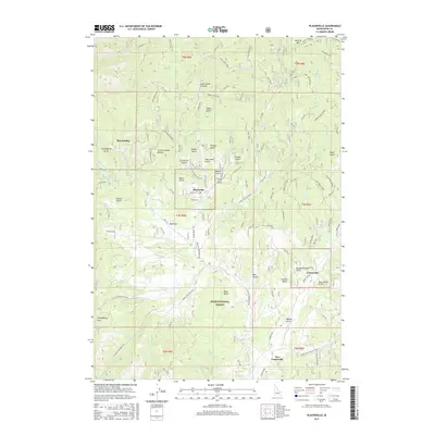
2017 Map of Placerville
USGS Topo · Published 2017About this map
Placerville and its surrounding Boise Basin mining district are defined by a network of steep gulches and creek drainages within the Boise National Forest. The map documents a cluster of settlements including Centerville, New Centerville, and Quartzburg, connected by forest service roads and local routes like California Gulch Rd. High points such as Alder Creek Summit and Mineral Mtn overlook a landscape carved by Grimes Cr and Granite Cr. The layout of the drainages, from Slaughterhouse Gulch to Treasure Gulch, suggests the intense historical hydraulic and placer mining activities that once dominated this region of Boise County. Modern utility is seen at the Treasure Gulch Airport, while numerous flats and ravines like Huckleberry Flat and Little Crooked Ravine provide specific geographic markers for local history and land use.
Find a feature on this map
123 named features on this map. Tap any name to fly to it.
Don’t see what you’re looking for? This feature index may not catch every label — zoom into the map to look around manually.
Map Details
Editions of this 2017 Placerville Map
This is the sole edition of this map. No revisions or reprints were ever made.
Other maps of this area

1892 · Boise
USGS Topo · 1:125,000

1894 · Squaw Creek
USGS Topo · 1:125,000

1894 · Idaho Basin
USGS Topo · 1:125,000

1897 · Boise
USGS Topo · 1:125,000

1909 · Garden Valley
USGS Topo · 1:125,000

1953 · Banks
USGS Topo · 1:62,500

1955 · Baker
USGS Topo · 1:250,000

1955 · Hailey
USGS Topo · 1:250,000

1955 · Boise
USGS Topo · 1:250,000

1957 · Placerville
USGS Topo · 1:24,000