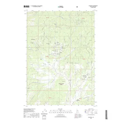
2020 Map of Placerville
USGS Topo · Published 2020About this map
Placerville stands as a central point in this Boise County landscape, situated within the northern reaches of the Boise National Forest. The map documents a rugged interior defined by the Boise Basin, where narrow gulches and steep ridgelines dictated the development of early settlements. From the heights of Mineral Mtn and Alder Creek Summit to the creek-side locations of Centerville and New Centerville, the placement of these towns reflects the legacy of the region's historic mining activity. Distinctive local names like Slab Cabin Gulch, Slaughterhouse Gulch, and Confederate Gulch speak to the specific character of the 19th-century boom years that shaped this terrain. Transportation remains tied to the land's contours, with the Grimes Pass Rd and Ida City-Horseshoe Bend road providing primary access through the mountain passes and along Granite Cr.
Find a feature on this map
80 named features on this map. Tap any name to fly to it.
Don’t see what you’re looking for? This feature index may not catch every label — zoom into the map to look around manually.
Map Details
Editions of this 2020 Placerville Map
This is the sole edition of this map. No revisions or reprints were ever made.
Other maps of this area

1892 · Boise
USGS Topo · 1:125,000

1894 · Squaw Creek
USGS Topo · 1:125,000

1894 · Idaho Basin
USGS Topo · 1:125,000

1897 · Boise
USGS Topo · 1:125,000

1909 · Garden Valley
USGS Topo · 1:125,000

1953 · Banks
USGS Topo · 1:62,500

1955 · Baker
USGS Topo · 1:250,000

1955 · Hailey
USGS Topo · 1:250,000

1955 · Boise
USGS Topo · 1:250,000

1957 · Placerville
USGS Topo · 1:24,000