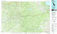
1976 Map of Placerville
USGS Topo · Published 1994About this map
Placerville and the Sierra foothills are captured in this mid-1970s survey, illustrating the complex geography of the Mother Lode and the high Sierra Nevada. The map documents the historic Gold Rush corridor along the South Fork American River, notably featuring the Marshall Gold Discovery State Historical Park at Coloma. This transition from the foothill settlements like Diamond Springs and Shingle Springs to the alpine terrain of the Crystal Range reveals the development of water infrastructure, including the Union Valley Reservoir and Ice House Reservoir, which reshaped the mountain landscape.
Find a feature on this map
134 named features on this map. Tap any name to fly to it.
Don’t see what you’re looking for? This feature index may not catch every label — zoom into the map to look around manually.
Map Details
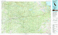
Editions of this 1976 Placerville Map
2 editions found
Other maps of this area

1888 · Smartsville
USGS Topo · 1:125,000

1889 · Jackson
USGS Topo · 1:125,000

1889 · Pyramid Peak
USGS Topo · 1:125,000

1889 · Markleeville
USGS Topo · 1:125,000

1891 · Sacramento
USGS Topo · 1:125,000

1891 · Carson
USGS Topo · 1:125,000

1891 · Markleeville
USGS Topo · 1:125,000

1891 · Colfax
USGS Topo · 1:125,000

1891 · Truckee
USGS Topo · 1:125,000

1891 · Big Trees
USGS Topo · 1:125,000