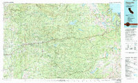
1976 Map of Placerville
USGS Topo · Published 1994About this map
The South Fork American River corridor serves as the primary axis of this survey, where gold rush history remains etched into the landscape at Marshall Gold Discovery State Historic Park in Coloma. The map reveals a transition from the foothill communities of Placerville, Diamond Springs, and Shingle Springs into the high elevations of the Sierra Nevada and the Desolation Wilderness. A complex water management system is evident through numerous reservoirs such as Union Valley Reservoir and Ice House Reservoir, which support the region's hydro-economy. Transport patterns are dominated by U.S. Highway 50 and the Camino Placerville & Lake Tahoe RR, connecting the timber and mining districts of the Georgetown Divide with the growing settlements of El Dorado County. Farther south, the rural character of Fiddletown and Grizzly Flat contrasts with the alpine terrain near Lake Tahoe and Pyramid Peak.
Find a feature on this map
146 named features on this map. Tap any name to fly to it.
Don’t see what you’re looking for? This feature index may not catch every label — zoom into the map to look around manually.
Map Details
Editions of this 1976 Placerville Map
2 editions found
Other maps of this area

1888 · Smartsville
USGS Topo · 1:125,000

1889 · Jackson
USGS Topo · 1:125,000

1889 · Pyramid Peak
USGS Topo · 1:125,000

1889 · Markleeville
USGS Topo · 1:125,000

1891 · Sacramento
USGS Topo · 1:125,000

1891 · Carson
USGS Topo · 1:125,000

1891 · Markleeville
USGS Topo · 1:125,000

1891 · Colfax
USGS Topo · 1:125,000

1891 · Truckee
USGS Topo · 1:125,000

1891 · Big Trees
USGS Topo · 1:125,000