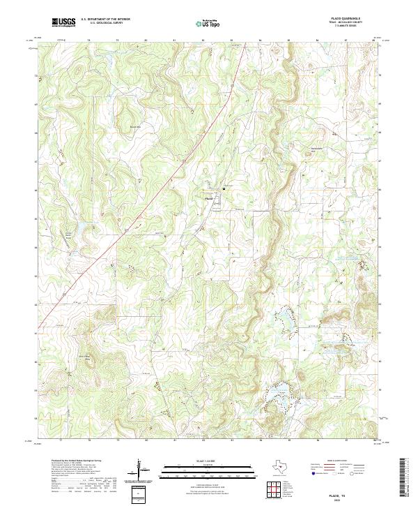
2022 Map of Placid
USGS Topo · Published 2022About this map
The small community of Placid serves as the focal point for this McCulloch County landscape, where the rolling elevations of the Corn Creek Hills meet a network of essential water management structures. The area is defined by its ranching heritage and conservation efforts, evidenced by the presence of the Soil Conservation Service Site 2 Reservoir and the Deep Cr Watershed Reservoir Number Two. Significant landmarks such as Round Mtn and Packsaddle Hill rise above the drainage basins of Corn Cr and Dry Prong Deep Cr. Local history is anchored at the Placid Cem, while the modern infrastructure of FM 2315 and FM 1028 provides the primary connectivity through these central Texas uplands. The distribution of ranch-named features like the Curtis Ranch Field and Z Ranch Lake reflects the enduring agricultural character of the region.
Find a feature on this map
41 named features on this map. Tap any name to fly to it.
Don’t see what you’re looking for? This feature index may not catch every label — zoom into the map to look around manually.
Map Details
Editions of this 2022 Placid Map
This is the sole edition of this map. No revisions or reprints were ever made.
Other maps of this area

1894 · Brady
USGS Topo · 1:125,000

1924 · Brady 2-a
USGS Topo · 1:48,000

1925 · Brady 1-b
USGS Topo · 1:48,000

1925 · Brady 1-a
USGS Topo · 1:48,000

1928 · Mercury
USGS Topo · 1:62,500

1928 · Waldrip
USGS Topo · 1:62,500

1950 · Mercury
USGS Topo · 1:62,500

1954 · Brownwood
USGS Topo · 1:250,000

1960 · Brady North
USGS Topo · 1:24,000
1963 · Lost Creek
USGS Topo · 1:24,000