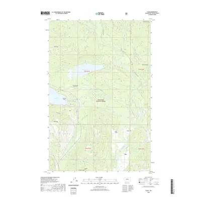
2020 Map of Plain
USGS Topo · Published 2020About this map
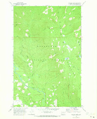
The settlement of Plain sits at the southern reach of this study, where the Wenatchee River winds through the valley floor. To the north, the landscape is defined by the convergence of several major watercourses, including the Chiwawa River, Nason Creek, and Fish Lake Run. This area within the Wenatchee National Forest contains a complex network of ridges and meadows, notably Nason Ridge and McDonald Ridge, which hem in the lowlands. Significant landmarks such as Fish Lake and the eastern tip of Lake Wenatchee, featuring Emerald Island, anchor the central terrain. The map also records the location of the Lake Wenatchee State Airport and recreational or agricultural clearings like Schugart Flat and Burgess Meadow. The diverse topography ranges from the steep walls of Pobst Canyon to the prominent peak of Natapoc Mtn, providing a clear record of the region's hydrological and geological structure.
Find a feature on this map
32 named features on this map. Tap any name to fly to it.
Don’t see what you’re looking for? This feature index may not catch every label — zoom into the map to look around manually.
Map Details
Editions of this 2020 Plain Map
This is the sole edition of this map. No revisions or reprints were ever made.
Other maps of this area

1901 · Chiwaukum
USGS Topo · 1:125,000

1904 · Chiwaukum
USGS Topo · 1:125,000

1957 · Wenatchee
USGS Topo · 1:250,000

1964 · Leavenworth
USGS Topo · 1:62,500

1965 · Chiwaukum Mts
USGS Topo · 1:62,500

1965 · Wenatchee Lake
USGS Topo · 1:62,500
1968 · Silver Falls
USGS Topo · 1:24,000
1968 · Sugarloaf Peak
USGS Topo · 1:24,000
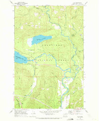
1968 · Plain
USGS Topo · 1:24,000
1968 · Chikamin Creek
USGS Topo · 1:24,000