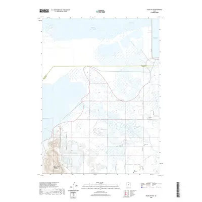
2020 Map of Plain City SW
USGS Topo · Published 2020About this map
Little Mountain and the marshy eastern shore of the Great Salt Lake dominate this 2020 landscape along the border of Box Elder and Weber counties. The area is defined by the complex water systems where Second Salt Creek and Little Weber Creek meet the bay, punctuated by the distinctive curves of The Horseshoe Bend. Historical memory is preserved at the John C Fremont Monument, marking a site of early exploration near the shoreline. Local heritage is further anchored by the Warren Cem and West Warren Cem, which serve as focal points for the rural communities of Warren and West Warren. Modern infrastructure, including the Little Mountain Rail Trail and the massive Willard Bay Reservoir, illustrates how contemporary water management and recreation have integrated with the natural wetlands of the lake's edge.
Find a feature on this map
34 named features on this map. Tap any name to fly to it.
Don’t see what you’re looking for? This feature index may not catch every label — zoom into the map to look around manually.
Map Details
Editions of this 2020 Plain City SW Map
This is the sole edition of this map. No revisions or reprints were ever made.
Other maps of this area

1954 · Whistler Canal
USGS Topo · 1:24,000

1954 · Brigham City
USGS Topo · 1:250,000

1955 · Plain City
USGS Topo · 1:24,000

1955 · Roy
USGS Topo · 1:24,000

1955 · Willard Spur
USGS Topo · 1:24,000

1955 · Mouth of Bear River
USGS Topo · 1:24,000

1955 · Plain City SW
USGS Topo · 1:24,000

1955 · Willard
USGS Topo · 1:24,000

1955 · Ogden Bay
USGS Topo · 1:24,000

1955 · Fremont Island
USGS Topo · 1:24,000