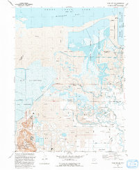
1991 Map of Plain City SW
USGS Topo · Published 1991About this map
The eastern shores of the Great Salt Lake define a landscape dominated by marshlands and industrial salt harvesting in the early 1990s. This survey details the complex water management required for both conservation and industry, featuring the extensive Harold S Crane Waterfowl Management Area and the Willard Bay State Wildlife Management Area alongside several Salt Evaporators. The southern portion of the map centers on the community of West Warren, where the Warren Canal and its various branches distribute water across the flat terrain to support local agriculture.
Find a feature on this map
39 named features on this map. Tap any name to fly to it.
Don’t see what you’re looking for? This feature index may not catch every label — zoom into the map to look around manually.
Map Details
Editions of this 1991 Plain City SW Map
This is the sole edition of this map. No revisions or reprints were ever made.
Other maps of this area

1954 · Whistler Canal
USGS Topo · 1:24,000

1954 · Brigham City
USGS Topo · 1:250,000

1955 · Plain City
USGS Topo · 1:24,000

1955 · Roy
USGS Topo · 1:24,000

1955 · Willard Spur
USGS Topo · 1:24,000

1955 · Mouth of Bear River
USGS Topo · 1:24,000

1955 · Plain City SW
USGS Topo · 1:24,000

1955 · Willard
USGS Topo · 1:24,000

1955 · Ogden Bay
USGS Topo · 1:24,000

1955 · Fremont Island
USGS Topo · 1:24,000