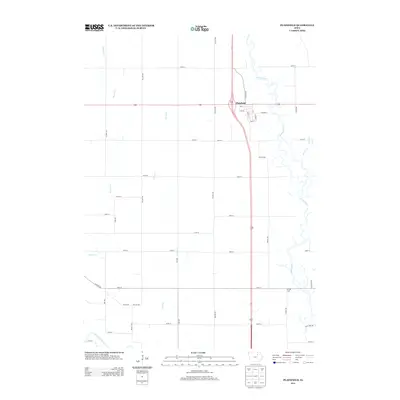
2013 Map of Plainfield
USGS Topo · Published 2013About this map
Plainfield occupies the northeastern corner of this Bremer County landscape, where the town plat is oriented along a grid of streets including Main St, Division St, and Mill St. The community is positioned just west of the winding Cedar River, which meanders through the eastern portion of the quadrangle. The surrounding agricultural land is defined by a rigorous sectional road system, with names like Butler Ave and Willow Ave carving the prairie into blocks. In the southwest, the Shell Rock River clips the corner of the map, while numerous smaller waterways such as Beaver Cr, Curry Cr, and Horton Cr drain the fields. South of Plainfield, Spring Lake appears as a distinct water feature near the intersection of 190th St and Casper Ave, offering a local landmark within the vast network of rural routes.
Find a feature on this map
39 named features on this map. Tap any name to fly to it.
Don’t see what you’re looking for? This feature index may not catch every label — zoom into the map to look around manually.
Map Details
Editions of this 2013 Plainfield Map
This is the sole edition of this map. No revisions or reprints were ever made.
Other maps of this area

1954 · Waterloo
USGS Topo · 1:250,000

1955 · Waterloo
USGS Topo · 1:250,000

1963 · Waverly
USGS Topo · 1:24,000

1971 · Shell Rock
USGS Topo · 1:24,000

1971 · Bremer
USGS Topo · 1:24,000

1971 · Tripoli NW
USGS Topo · 1:24,000

1971 · Coster
USGS Topo · 1:24,000

1971 · Plainfield
USGS Topo · 1:24,000

1971 · Nashua NW
USGS Topo · 1:24,000

1971 · Clarksville
USGS Topo · 1:24,000