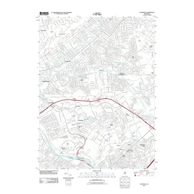
2011 Map of Plainfield
USGS Topo · Published 2011About this map
East Jersey Olde Towne anchors the southern boundary of this Middlesex County study, situated along the Raritan River and the historic Delaware and Raritan Canal. This area reflects a dense suburban landscape where modern infrastructure like Interstate 287 and the New Jersey Turnpike bisects long-established communities. Industrial and early commercial history is visible through the Middlesex Milling Dam at New Market Pond and the Nixon Post Office.
Find a feature on this map
58 named features on this map. Tap any name to fly to it.
Don’t see what you’re looking for? This feature index may not catch every label — zoom into the map to look around manually.
Map Details
Editions of this 2011 Plainfield Map
This is the sole edition of this map. No revisions or reprints were ever made.
Other maps of this area

1888 · Plainfield
USGS Topo · 1:62,500

1888 · New Brunswick
USGS Topo · 1:62,500

1888 · Princeton
USGS Topo · 1:62,500

1891 · Somerville
USGS Topo · 1:62,500

1893 · New Brunswick
USGS Topo · 1:62,500

1893 · Plainfield
USGS Topo · 1:62,500

1893 · Somerville
USGS Topo · 1:62,500

1894 · Princeton
USGS Topo · 1:62,500

1898 · Plainfield
USGS Topo · 1:62,500

1898 · Somerville
USGS Topo · 1:62,500