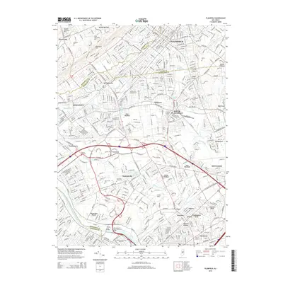
2014 Map of Plainfield
USGS Topo · Published 2014About this map
The Raritan River and Delaware and Raritan Canal anchor the southern boundary of this detailed suburban corridor, where the historic landscape of Middlesex and Union counties meets the rising elevations of First Watchung Mtn and Second Watchung Mtn. The dense network of communities, including South Plainfield, Dunellen, and Piscataway, is punctuated by numerous memorial sites such as Stelle Cem, Hillside Cem, and Lake Nelson Memorial Cem. Academic and recreational landmarks are prominent, from the Rutgers University-New Brunswick campus near the John A Lynch Senior Memorial Bridge to the distinctive Kilmer Bowl. The map highlights the transition from the flatlands of Ambrose Brook to the landmark Washington Rock, offering a perspective on how transportation routes like Us-22 and River Rd have shaped the growth of settlements like New Durham, Stelton, and Randolphville.
Find a feature on this map
71 named features on this map. Tap any name to fly to it.
Don’t see what you’re looking for? This feature index may not catch every label — zoom into the map to look around manually.
Map Details
Editions of this 2014 Plainfield Map
This is the sole edition of this map. No revisions or reprints were ever made.
Other maps of this area

1888 · Plainfield
USGS Topo · 1:62,500

1888 · New Brunswick
USGS Topo · 1:62,500

1888 · Princeton
USGS Topo · 1:62,500

1891 · Somerville
USGS Topo · 1:62,500

1893 · New Brunswick
USGS Topo · 1:62,500

1893 · Plainfield
USGS Topo · 1:62,500

1893 · Somerville
USGS Topo · 1:62,500

1894 · Princeton
USGS Topo · 1:62,500

1898 · Plainfield
USGS Topo · 1:62,500

1898 · Somerville
USGS Topo · 1:62,500