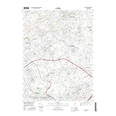
2016 Map of Plainfield
USGS Topo · Published 2016About this map
Plainfield and its surrounding boroughs are defined by the dramatic rise of the First Watchung Mtn and Second Watchung Mtn to the northwest, where Washington Rock provides a landmark overlook of the suburban landscape. The region's history is anchored in the dense network of early settlements like Dunellen, New Market, and Metuchen, which evolved around the waterways of Green Brook and Ambrose Brook. In the south, the Raritan River corridor is a focal point for infrastructure and education, featuring the Delaware and Raritan Canal and the sprawling campus of Rutgers University-New Brunswick. This modern survey documents the extensive residential and commercial development of South Plainfield and Edison, while preserving the locations of numerous memorial sites including Lake Nelson Memorial Cem and Resurrection Cem.
Find a feature on this map
60 named features on this map. Tap any name to fly to it.
Don’t see what you’re looking for? This feature index may not catch every label — zoom into the map to look around manually.
Map Details
Editions of this 2016 Plainfield Map
This is the sole edition of this map. No revisions or reprints were ever made.
Other maps of this area

1888 · Plainfield
USGS Topo · 1:62,500

1888 · New Brunswick
USGS Topo · 1:62,500

1888 · Princeton
USGS Topo · 1:62,500

1891 · Somerville
USGS Topo · 1:62,500

1893 · New Brunswick
USGS Topo · 1:62,500

1893 · Plainfield
USGS Topo · 1:62,500

1893 · Somerville
USGS Topo · 1:62,500

1894 · Princeton
USGS Topo · 1:62,500

1898 · Plainfield
USGS Topo · 1:62,500

1898 · Somerville
USGS Topo · 1:62,500