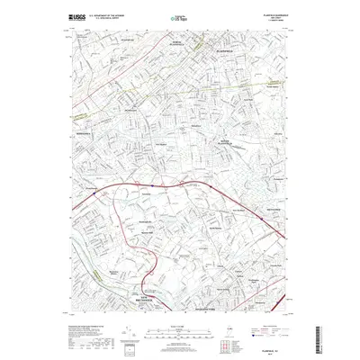
2019 Map of Plainfield
USGS Topo · Published 2019About this map
Watchung Mountain and First Watchung Mountain rise over a dense suburban landscape where the borders of Somerset, Union, and Middlesex Counties meet. The area is defined by its complex network of interconnected settlements, including North Plainfield, Dunellen, and South Plainfield, while the southern reaches follow the curve of the Raritan River and the historical path of the Delaware and Raritan Canal. Genealogists will find several burial grounds across the quadrangle, from the Hillside Cemetery in the north to the Saint James Episcopal Church Cemetery in Piscataway. The presence of the Rutgers University Livingston Campus and Union County College highlights the region's educational development. Transport remains a dominant theme, with the massive interchange of Interstate 287 and Interstate 95 cutting through Edison and Metuchen, adjacent to the rail corridors of Conrail.
Find a feature on this map
67 named features on this map. Tap any name to fly to it.
Don’t see what you’re looking for? This feature index may not catch every label — zoom into the map to look around manually.
Map Details
Editions of this 2019 Plainfield Map
This is the sole edition of this map. No revisions or reprints were ever made.
Other maps of this area

1888 · Plainfield
USGS Topo · 1:62,500

1888 · New Brunswick
USGS Topo · 1:62,500

1888 · Princeton
USGS Topo · 1:62,500

1891 · Somerville
USGS Topo · 1:62,500

1893 · New Brunswick
USGS Topo · 1:62,500

1893 · Plainfield
USGS Topo · 1:62,500

1893 · Somerville
USGS Topo · 1:62,500

1894 · Princeton
USGS Topo · 1:62,500

1898 · Plainfield
USGS Topo · 1:62,500

1898 · Somerville
USGS Topo · 1:62,500