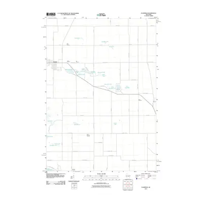
2010 Map of Plainfield
USGS Topo · Published 2010About this map
Plainfield occupies the western edge of this central Wisconsin landscape, where the town layout meets a dense cluster of glacial kettle lakes. This high density of small water bodies, including Plainfield Lake, Sherman Lake, and the uniquely named Pumpkin Seed Lake, suggests a complex post-glacial terrain that has historically dictated local road patterns and land use. The area is characterized by a grid of agricultural corridors like Archer Ave and County Hwy-P that navigate around these natural depressions.
Find a feature on this map
63 named features on this map. Tap any name to fly to it.
Don’t see what you’re looking for? This feature index may not catch every label — zoom into the map to look around manually.
Map Details
Editions of this 2010 Plainfield Map
This is the sole edition of this map. No revisions or reprints were ever made.
Other maps of this area

1955 · Green Bay
USGS Topo · 1:250,000

1957 · Amherst
USGS Topo · 1:48,000

1957 · Whiting
USGS Topo · 1:48,000

1958 · Coloma
USGS Topo · 1:48,000

1959 · Wautoma
USGS Topo · 1:48,000

1968 · Coloma
USGS Topo · 1:24,000

1968 · Richford
USGS Topo · 1:24,000

1968 · Plainfield
USGS Topo · 1:24,000
1968 · Wautoma
USGS Topo · 1:24,000

1968 · Hancock
USGS Topo · 1:24,000