
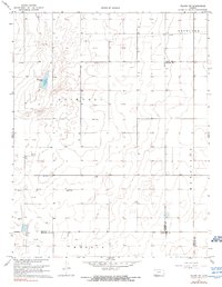
1968 Map of Plains NW
USGS Topo · Published 1969About this map
Ellsaesser Pond and a network of Gas Wells define the landscape of Southwest Kansas in this late 1960s survey. The area sits at a complex junction of civil boundaries, where the corners of Haskell, Meade, and Seward counties meet. The township divisions of Lockport, Copeland, Mertilla, and Morris organize the high plains terrain, which is otherwise marked by subterranean energy infrastructure and scattered landmarks like a Radio Tower. The distribution of wells and the linear path of the Pipeline through the northern sections reflect the mid-century industrialization of the Hugoton Gas Area. This map is particularly useful for understanding the exact placement of land divisions and water features in an area where few large settlements exist.
Find a feature on this map
12 named features on this map. Tap any name to fly to it.
Don’t see what you’re looking for? This feature index may not catch every label — zoom into the map to look around manually.
Map Details
Editions of this 1968 Plains NW Map
2 editions found
Other maps of this area

1896 · Garden
USGS Topo · 1:125,000

1955 · Dodge City
USGS Topo · 1:250,000

1958 · Dodge City
USGS Topo · 1:250,000

1959 · Dodge City
USGS Topo · 1:250,000

1960 · Garden City 3 SE
USGS Topo · 1:24,000

1963 · Plains
USGS Topo · 1:24,000

1967 · Plains NE
USGS Topo · 1:24,000

1968 · Plains SW
USGS Topo · 1:24,000

1968 · Sublette SE
USGS Topo · 1:24,000
1968 · Sublette
USGS Topo · 1:24,000