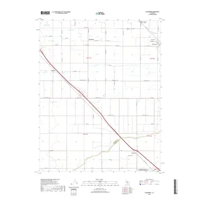
2018 Map of Plainsburg
USGS Topo · Published 2018About this map
The San Joaquin Valley landscape here is defined by an intricate network of waterways and a rigid grid of agricultural roads. Several historic settlements punctuate the terrain, including Le Grand, Plainsburg, and Athlone, while the northern reach of Chowchilla extends into the southern edge of the survey. The Helm-Turner Cem serves as a significant genealogical landmark, located south of Mariposa Creek. The land's hydrological history is visible in the various branches of the slough system, including North Slough, Middle Slough, and South Slough, which weave through the agricultural parcels alongside Deadman Cr. The arrival of the railroad and highways, such as those passing through Minturn, historically facilitated the movement of goods through this productive region of the Central Valley.
Find a feature on this map
67 named features on this map. Tap any name to fly to it.
Don’t see what you’re looking for? This feature index may not catch every label — zoom into the map to look around manually.
Map Details
Editions of this 2018 Plainsburg Map
This is the sole edition of this map. No revisions or reprints were ever made.
Other maps of this area

1914 · Merced
USGS Topo · 1:31,680

1915 · Owens Creek
USGS Topo · 1:31,680

1916 · Berenda
USGS Topo · 1:31,680

1917 · Merced
USGS Topo · 1:31,680

1918 · Bliss Ranch
USGS Topo · 1:31,680

1918 · Owens Creek
USGS Topo · 1:31,680

1918 · Lingard
USGS Topo · 1:31,680

1918 · Chowchilla
USGS Topo · 1:31,680

1918 · Berenda
USGS Topo · 1:31,680

1918 · Planada
USGS Topo · 1:31,680