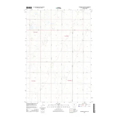
2015 Map of Plainview Colony NE
USGS Topo · Published 2015About this map
Foot Cr winds through the northern portion of this prairie landscape in McPherson County, representing the primary drainage for this segment of the Great Plains. The map reveals a strict Public Land Survey System geometry, with the terrain divided into the townships of t126n r69w, t126n r68w, t125n r69w, and t125n r68w. This rigid grid is reflected in the section-line road network, where north-south corridors like 354th Ave and 358th Ave intersect with east-west routes such as 115th St and 120th St. This layout illustrates the enduring influence of the 19th-century land disposal acts on the modern South Dakota agricultural footprint, where nearly every mile is punctuated by a maintained thoroughfare or a section boundary.
Find a feature on this map
18 named features on this map. Tap any name to fly to it.
Don’t see what you’re looking for? This feature index may not catch every label — zoom into the map to look around manually.
Map Details
Editions of this 2015 Plainview Colony NE Map
This is the sole edition of this map. No revisions or reprints were ever made.
Other maps of this area

1899 · Ellendale
USGS Topo · 1:125,000

1954 · Aberdeen
USGS Topo · 1:250,000

1956 · Aberdeen
USGS Topo · 1:250,000

1968 · Long Lake
USGS Topo · 1:24,000

1968 · Long Lake SE
USGS Topo · 1:24,000

1968 · Forbes SW
USGS Topo · 1:24,000

1970 · Leola
USGS Topo · 1:24,000

1970 · Leola SW
USGS Topo · 1:24,000
1978 · Plainview Colony
USGS Topo · 1:24,000
1978 · Plainview Colony NE
USGS Topo · 1:24,000