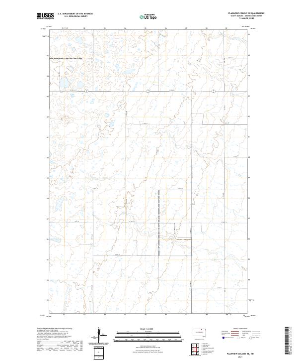
2021 Map of Plainview Colony NE
USGS Topo · Published 2021About this map
McPherson County's interior prairie landscape is defined by the ephemeral drainage of Foot Cr, which meanders through the northern reaches of this rural township. The terrain is structured by a rigorous grid of section lines, where the vastness of the plains is carved into distinct territories like t126n r69w and t126n r68w. This 2021 survey illustrates a sparse settlement pattern characteristic of contemporary South Dakota, where the economy remains rooted in expansive agricultural parcels and a network of gravel and paved thoroughfares.
Find a feature on this map
20 named features on this map. Tap any name to fly to it.
Don’t see what you’re looking for? This feature index may not catch every label — zoom into the map to look around manually.
Map Details
Editions of this 2021 Plainview Colony NE Map
This is the sole edition of this map. No revisions or reprints were ever made.
Other maps of this area

1899 · Ellendale
USGS Topo · 1:125,000

1954 · Aberdeen
USGS Topo · 1:250,000

1956 · Aberdeen
USGS Topo · 1:250,000

1968 · Long Lake
USGS Topo · 1:24,000

1968 · Long Lake SE
USGS Topo · 1:24,000

1968 · Forbes SW
USGS Topo · 1:24,000

1970 · Leola
USGS Topo · 1:24,000

1970 · Leola SW
USGS Topo · 1:24,000
1978 · Plainview Colony
USGS Topo · 1:24,000
1978 · Plainview Colony NE
USGS Topo · 1:24,000