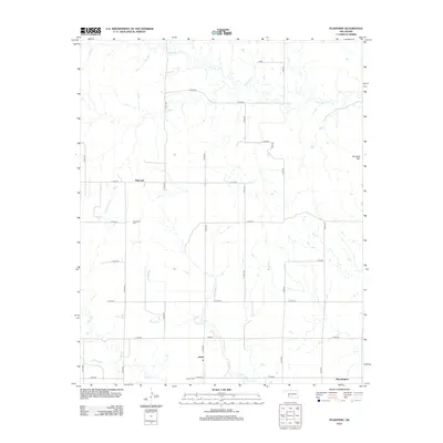
2012 Map of Plainview
USGS Topo · Published 2012About this map
Plainview and Jester occupy the heart of this Western Oklahoma landscape, where the flat agricultural terrain is defined by a rigorous grid of section-line roads. The area is drained by a series of south-flowing waterways, including Station Cr and Deer Cr, which carve subtle paths through the prairie. In the eastern reaches of the quadrangle, Haystack Mtn rises as a prominent landmark above the surrounding plains. For genealogists and local historians, the map documents the centers of community life in this rural stretch of Greer County, from the southernmost settlement of Bloomington to the critical local burial grounds at Plainview Cem and Jester Cem. The naming of northern water features like Haystack Cr further ties the local hydrology to the area's distinctive topography.
Find a feature on this map
26 named features on this map. Tap any name to fly to it.
Don’t see what you’re looking for? This feature index may not catch every label — zoom into the map to look around manually.
Map Details
Editions of this 2012 Plainview Map
This is the sole edition of this map. No revisions or reprints were ever made.
Other maps of this area

1955 · Lawton
USGS Topo · 1:250,000

1955 · Clinton
USGS Topo · 1:250,000

1957 · Clinton
USGS Topo · 1:250,000

1961 · Willow
USGS Topo · 1:62,500

1961 · Erick
USGS Topo · 1:62,500

1971 · Mangum North
USGS Topo · 1:24,000

1971 · Vinson
USGS Topo · 1:24,000

1971 · Reed
USGS Topo · 1:24,000

1985 · Elk City
USGS Topo · 1:100,000

1985 · Altus
USGS Topo · 1:100,000