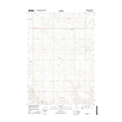
2015 Map of Plainview
USGS Topo · Published 2015About this map
Plainview serves as a central point in this northern South Dakota landscape, where the prairie is defined by a dendritic network of intermittent watercourses and small upland lakes. Several prominent catchments, including Plainview Hughes Lake, Nuzum Lake, and Wilson Lake, dot the high ground between the drainage basins of Narcelle Cr and its western branch. The terrain reveals the subtle hydrology of the region, where seasonal flows like Deere Cr and Timber Cr carve paths through the township sections.
Find a feature on this map
22 named features on this map. Tap any name to fly to it.
Don’t see what you’re looking for? This feature index may not catch every label — zoom into the map to look around manually.
Map Details
Editions of this 2015 Plainview Map
This is the sole edition of this map. No revisions or reprints were ever made.
Other maps of this area

1953 · Rapid City
USGS Topo · 1:250,000

1954 · Dalzell NE
USGS Topo · 1:24,000

1955 · Pedro
USGS Topo · 1:24,000

1955 · Pedro NW
USGS Topo · 1:24,000

1955 · Howes
USGS Topo · 1:24,000

1957 · Rapid City
USGS Topo · 1:250,000

1983 · Plainview
USGS Topo · 1:24,000
1983 · Lemmon Creek
USGS Topo · 1:24,000
1983 · Whiteman Owl SE
USGS Topo · 1:24,000

1983 · Marcus
USGS Topo · 1:24,000