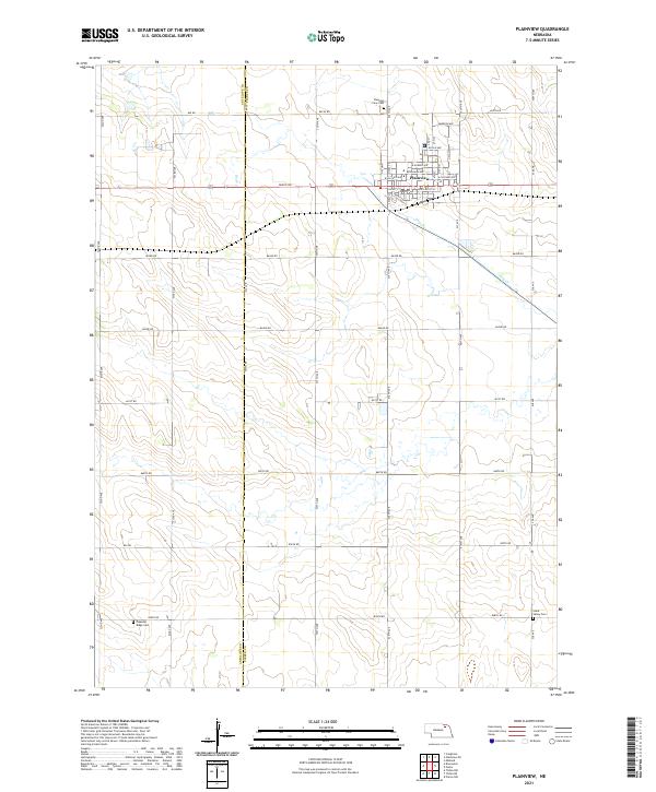
2021 Map of Plainview
USGS Topo · Published 2021About this map
Plainview serves as the primary hub of this eastern Nebraska landscape, situated near the intersection of several section-line roads and the seasonal drainage of Dry Cr. The town's grid is well-defined by thoroughfares such as Woodland Ave, Euclid Ave, and Emerson Ave, reflecting the systematic agricultural development of the region. This survey delineates the jurisdictional boundary between Antelope Co and Pierce Co, illustrating how early territorial divisions continue to shape the local geography. Beyond the municipal limits, the map reveals a history of rural community life preserved through several localized burial grounds. Genealogists and local historians can locate Pleasant View Cem, Pleasant Ridge Cem, and Stark Valley Cem, each positioned to serve the farming families across the surrounding townships.
Find a feature on this map
50 named features on this map. Tap any name to fly to it.
Don’t see what you’re looking for? This feature index may not catch every label — zoom into the map to look around manually.
Map Details
Editions of this 2021 Plainview Map
This is the sole edition of this map. No revisions or reprints were ever made.
Other maps of this area

1955 · Sioux City
USGS Topo · 1:250,000

1958 · Sioux City
USGS Topo · 1:250,000

1959 · Sioux City
USGS Topo · 1:250,000

1963 · Pierce NW
USGS Topo · 1:24,000

1963 · Plainview
USGS Topo · 1:24,000

1963 · Brunswick
USGS Topo · 1:24,000

1963 · Foster
USGS Topo · 1:24,000
1963 · Tilden NE
USGS Topo · 1:24,000
1963 · Tilden NW
USGS Topo · 1:24,000

1974 · Midland
USGS Topo · 1:24,000