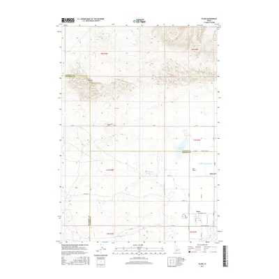
2017 Map of Plano
USGS Topo · Published 2017About this map
Canal networks define the agricultural landscape of this corner of Southeast Idaho, where the Saint Anthony Union Canal and Independent Canal cut through the high plains near the border of Madison and Jefferson counties. The settlement of Plano serves as a local anchor, centered near the Plano Cem and the Plano Townsite Rd corridor. To the north, the terrain shifts from the irrigated flats of the Egin Bench toward the distinct volcanic and aeolian features of Sand Mtn and Ninemile Knoll. These landmarks provide vertical relief against a backdrop of organized rural section lines and water diversions like the N Br Independent Canal, reflecting a century of sophisticated water management in the Snake River Valley. The presence of Quayles Lake and the small siding at Edmonds further illustrates the intersection of natural hydrology and human engineering required to sustain life in this high-desert environment.
Find a feature on this map
30 named features on this map. Tap any name to fly to it.
Don’t see what you’re looking for? This feature index may not catch every label — zoom into the map to look around manually.
Map Details
Editions of this 2017 Plano Map
This is the sole edition of this map. No revisions or reprints were ever made.
Other maps of this area

1948 · Parker
USGS Topo · 1:24,000

1949 · Rexburg
USGS Topo · 1:24,000

1950 · Parker
USGS Topo · 1:24,000

1950 · Rexburg
USGS Topo · 1:24,000
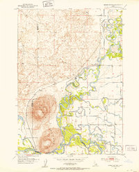
1951 · Menan Buttes
USGS Topo · 1:24,000

1951 · Plano
USGS Topo · 1:24,000

1955 · Dubois
USGS Topo · 1:250,000

1955 · Idaho Falls
USGS Topo · 1:250,000

1955 · Ashton
USGS Topo · 1:250,000

1955 · Driggs
USGS Topo · 1:250,000