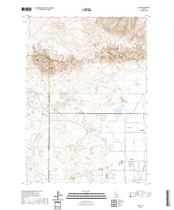
2023 Map of Plano
USGS Topo · Published 2023About this map
Plano and the adjacent settlement of Edmonds anchor this agricultural landscape in eastern Idaho, where three counties—Jefferson, Fremont, and Madison—converge. The region is defined by an extensive network of irrigation infrastructure essential to the Egin Bench, including the Saint Anthony Canal, the Independent Canal, and the Saint-Anthony-Union-Canal. These waterways contrast sharply with the arid northern terrain, which rises into the South Junipers and features prominent landmarks such as Sand Mtn and Ninemile Knoll. Local history is centered on the townsite, where the Plano Cemetery sits near the junction of Plano Road and Plano Townsite Road. The presence of Quayles Lake and various canal branches highlights the sophisticated water management required to support the local farming economy amidst the surrounding high-desert environment.
Find a feature on this map
36 named features on this map. Tap any name to fly to it.
Don’t see what you’re looking for? This feature index may not catch every label — zoom into the map to look around manually.
Map Details
Editions of this 2023 Plano Map
This is the sole edition of this map. No revisions or reprints were ever made.
Other maps of this area

1948 · Parker
USGS Topo · 1:24,000

1949 · Rexburg
USGS Topo · 1:24,000

1950 · Parker
USGS Topo · 1:24,000

1950 · Rexburg
USGS Topo · 1:24,000
1951 · Menan Buttes
USGS Topo · 1:24,000

1951 · Plano
USGS Topo · 1:24,000

1955 · Dubois
USGS Topo · 1:250,000

1955 · Idaho Falls
USGS Topo · 1:250,000

1955 · Ashton
USGS Topo · 1:250,000

1955 · Driggs
USGS Topo · 1:250,000