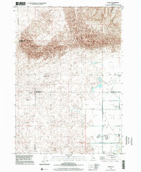
1998 Map of Plano
USGS Topo · Published 2002About this map
S A N D D U N E S and shifting landscape forms dominate the northern reaches of this Idaho survey, where Sand Mountain rises above the surrounding terrain. This arid geography transitions into a managed agricultural corridor to the south, defined by an intricate network of irrigation features including the St Anthony Canal and North Branch Independent. The layout of these water systems reflects the critical infrastructure required for settlement in this part of Fremont and Madison counties during the late twentieth century.
Find a feature on this map
18 named features on this map. Tap any name to fly to it.
Don’t see what you’re looking for? This feature index may not catch every label — zoom into the map to look around manually.
Map Details
Editions of this 1998 Plano Map
This is the sole edition of this map. No revisions or reprints were ever made.
Other maps of this area

1948 · Parker
USGS Topo · 1:24,000

1949 · Rexburg
USGS Topo · 1:24,000

1950 · Parker
USGS Topo · 1:24,000

1950 · Rexburg
USGS Topo · 1:24,000
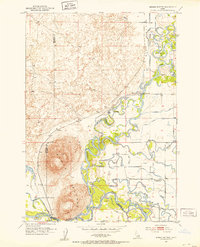
1951 · Menan Buttes
USGS Topo · 1:24,000

1951 · Plano
USGS Topo · 1:24,000

1955 · Dubois
USGS Topo · 1:250,000

1955 · Idaho Falls
USGS Topo · 1:250,000

1955 · Ashton
USGS Topo · 1:250,000

1955 · Driggs
USGS Topo · 1:250,000