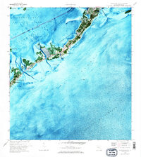
1971 Map of Plantation Key
USGS Topo · Published 1973About this map
Plantation Key and its surrounding waters are captured here in the early 1970s, showcasing a landscape defined by the transition from the wild Everglades National Park to the developing island chain. This orthophotomap provides a rare hybrid view of the Upper Keys, where the natural expanse of Florida Bay and the Straits of Florida meet the growing footprint of Islamorada. Residential developments like Taurus are visible alongside essential community markers including the Coral Shores Sch, San Pedro Ch, and Island Community Ch.
Find a feature on this map
34 named features on this map. Tap any name to fly to it.
Don’t see what you’re looking for? This feature index may not catch every label — zoom into the map to look around manually.
Map Details
Editions of this 1971 Plantation Key Map
2 editions found
Other maps of this area

1947 · Rock Harbor
USGS Topo · 1:24,000

1949 · Rock Harbor
USGS Topo · 1:24,000

1956 · Miami
USGS Topo · 1:250,000

1958 · Miami
USGS Topo · 1:250,000

1971 · Upper Matecumbe Key
USGS Topo · 1:24,000

1971 · Tavernier
USGS Topo · 1:24,000

1971 · Plantation Key
USGS Topo · 1:24,000
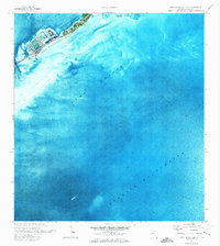
1971 · Lower Matecumbe Key
USGS Topo · 1:24,000

1972 · Calusa Keys
USGS Topo · 1:24,000
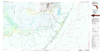
1982 · Homestead
USGS Topo · 1:100,000
Featured Places
- Islamorada, FL
- Plantation Key, FL
- Plantation Key Colony, Islamorada
- Plantation, Islamorada
- Monroe County, FL