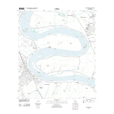
2012 Map of Plaquemine
USGS Topo · Published 2012About this map
The Mississippi River carves a massive, winding path through this region south of Baton Rouge, defining the layout of historic riverfront settlements and agricultural land. The city of Plaquemine serves as a primary hub on the west bank, surrounded by established residential areas like Seymourville and Turnerville. This 2012 survey illustrates the enduring presence of expansive riverfront estates, including the Saint Louis Plantation and Evergreen Plantation, which occupy large tracts of land along the levees.
Find a feature on this map
171 named features on this map. Tap any name to fly to it.
Don’t see what you’re looking for? This feature index may not catch every label — zoom into the map to look around manually.
Map Details
Editions of this 2012 Plaquemine Map
This is the sole edition of this map. No revisions or reprints were ever made.
Other maps of this area

1908 · Baton Rouge
USGS Topo · 1:62,500

1935 · Chicot Lake
USGS Topo · 1:62,500

1936 · White Castle
USGS Topo · 1:62,500

1939 · Baton Rouge
USGS Topo · 1:62,500

1940 · Grosse Tete
USGS Topo · 1:62,500

1953 · Baton Rouge West
USGS Topo · 1:24,000

1953 · Crescent
USGS Topo · 1:24,000

1953 · Plaquemine
USGS Topo · 1:24,000

1953 · Lobdell
USGS Topo · 1:24,000

1953 · Addis
USGS Topo · 1:24,000