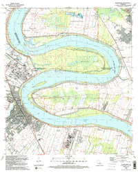
1992 Map of Plaquemine
USGS Topo · Published 1992About this map
The Mississippi River creates a serpentine landscape of dramatic peninsulas in this survey of the river corridor south of Baton Rouge. This environment is defined by its deep bends, including Duncan Point, Manchac Point, and Plaquemine Point, which have historically dictated the placement of agricultural and industrial operations. The western bank is anchored by the city of Plaquemine, where the historic Plaquemine Lock marks the junction with Plaquemine Bayou.
Find a feature on this map
60 named features on this map. Tap any name to fly to it.
Don’t see what you’re looking for? This feature index may not catch every label — zoom into the map to look around manually.
Map Details
Editions of this 1992 Plaquemine Map
2 editions found
Other maps of this area

1908 · Baton Rouge
USGS Topo · 1:62,500

1935 · Chicot Lake
USGS Topo · 1:62,500

1936 · White Castle
USGS Topo · 1:62,500

1939 · Baton Rouge
USGS Topo · 1:62,500

1940 · Grosse Tete
USGS Topo · 1:62,500

1953 · Baton Rouge West
USGS Topo · 1:24,000

1953 · Crescent
USGS Topo · 1:24,000

1953 · Plaquemine
USGS Topo · 1:24,000

1953 · Lobdell
USGS Topo · 1:24,000

1953 · Addis
USGS Topo · 1:24,000