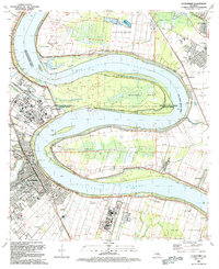
1992 Map of Plaquemine
USGS Topo · Published 1992About this map
The Mississippi River creates a massive, sweeping curve that defines this landscape, separating the Iberville and West Baton Rouge Parish lines via dramatic bends at Duncan Point and Manchac Point. In this early 1990s record, the transition from large-scale agriculture to industrial extraction is evident. Historic riverside estates like St Louis Plantation, Cottage Plantation, and Evergreen Plantation sit adjacent to modern energy infrastructure, including the Sunshine Oil Field and Point Pleasant Gas Field. The town of Plaquemine serves as the focal point, where the Plaquemine Lock connects the river to Bayou Plaquemine. Local life is anchored by established neighborhood markers such as St Johns High Sch, the Laboring Society Hall, and the Iberville Parish Civic Center. Smaller settlements like Morrisonville and Turnerville line the western bank, illustrating the persistent settlement patterns along the river's levee system.
Find a feature on this map
67 named features on this map. Tap any name to fly to it.
Don’t see what you’re looking for? This feature index may not catch every label — zoom into the map to look around manually.
Map Details
Editions of this 1992 Plaquemine Map
2 editions found
Other maps of this area

1908 · Baton Rouge
USGS Topo · 1:62,500

1935 · Chicot Lake
USGS Topo · 1:62,500

1936 · White Castle
USGS Topo · 1:62,500

1939 · Baton Rouge
USGS Topo · 1:62,500

1940 · Grosse Tete
USGS Topo · 1:62,500

1953 · Baton Rouge West
USGS Topo · 1:24,000

1953 · Crescent
USGS Topo · 1:24,000

1953 · Plaquemine
USGS Topo · 1:24,000

1953 · Lobdell
USGS Topo · 1:24,000

1953 · Addis
USGS Topo · 1:24,000