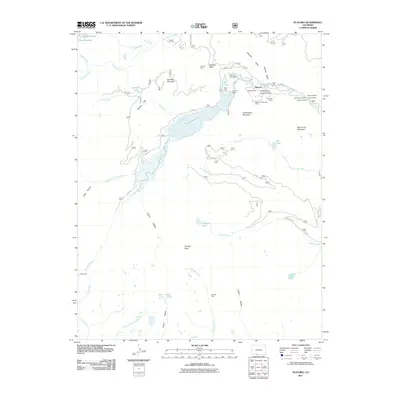
2011 Map of Platoro
USGS Topo · Published 2011About this map
Platoro sits at the heart of this high-elevation landscape, where the Conejos River meets the waters released by the Platoro Dam. The surrounding mountains are marked by a significant mining legacy, with numerous claims clustered east of the reservoir. Notable sites include the Siskiyou Mine, Glacier Mine, and the Mammoth Revenue Mine, reflecting the intensive prospecting history of the eastern slopes. To the south, the terrain rises toward Conejos Peak, overlooking a network of alpine basins containing Tobacco Lake, Twin Lakes, and Bear Lake.
Find a feature on this map
52 named features on this map. Tap any name to fly to it.
Don’t see what you’re looking for? This feature index may not catch every label — zoom into the map to look around manually.
Map Details
Editions of this 2011 Platoro Map
This is the sole edition of this map. No revisions or reprints were ever made.
Other maps of this area

1913 · Summitville
USGS Topo · 1:125,000

1915 · Summitville
USGS Topo · 1:125,000

1922 · Conejos
USGS Topo · 1:125,000

1945 · Durango
USGS Topo · 1:250,000

1953 · Durango
USGS Topo · 1:250,000

1954 · Durango
USGS Topo · 1:250,000

1957 · Chama Peak
USGS Topo · 1:62,500

1961 · Durango
USGS Topo · 1:250,000

1963 · Durango
USGS Topo · 1:250,000

1966 · Durango
USGS Topo · 1:250,000