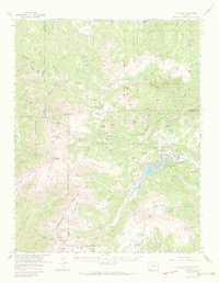
1967 Map of Platoro
USGS Topo · Published 1972About this map
The Continental Divide forms a jagged spine through this high-altitude landscape, separating the headwaters of the Alamosa River and the East Fork San Juan River. In the late 1960s, the settlement of Platoro stood as a primary hub for mining and water management, situated just east of the expansive Platoro Reservoir. The area's industrial history is etched into the peaks, where the Mammoth Revenue Mine and several tunnels, including the Iowa Tunnel and French Tunnel, mark the legacy of mineral extraction in the San Juan Mountains.
Find a feature on this map
78 named features on this map. Tap any name to fly to it.
Don’t see what you’re looking for? This feature index may not catch every label — zoom into the map to look around manually.
Map Details
Editions of this 1967 Platoro Map
2 editions found
Other maps of this area

1913 · Summitville
USGS Topo · 1:125,000

1914 · Creede
USGS Topo · 1:125,000

1915 · Summitville
USGS Topo · 1:125,000

1915 · Del Norte
USGS Topo · 1:125,000

1916 · Creede
USGS Topo · 1:125,000

1917 · Del Norte
USGS Topo · 1:125,000

1922 · Conejos
USGS Topo · 1:125,000

1945 · Durango
USGS Topo · 1:250,000

1953 · Durango
USGS Topo · 1:250,000

1954 · Durango
USGS Topo · 1:250,000