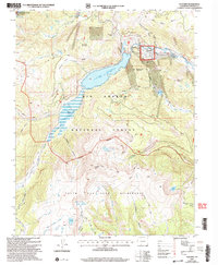
2001 Map of Platoro
USGS Topo · Published 2005About this map
The high mountain settlement of Platoro serves as the focal point for this high-elevation Colorado survey, situated at the upper reaches of the Conejos River. The landscape is dominated by the Platoro Reservoir, which regulates the river's flow through the Rio Grande National Forest. Evidence of the area's prospecting history is found on the slopes of Forest King Mountain and at the Mammoth Revenue Mine, reflecting the mineral pursuits that characterized the San Juan Mountains.
Find a feature on this map
92 named features on this map. Tap any name to fly to it.
Don’t see what you’re looking for? This feature index may not catch every label — zoom into the map to look around manually.
Map Details
Editions of this 2001 Platoro Map
This is the sole edition of this map. No revisions or reprints were ever made.
Other maps of this area

1913 · Summitville
USGS Topo · 1:125,000

1915 · Summitville
USGS Topo · 1:125,000

1922 · Conejos
USGS Topo · 1:125,000

1945 · Durango
USGS Topo · 1:250,000

1953 · Durango
USGS Topo · 1:250,000

1954 · Durango
USGS Topo · 1:250,000

1957 · Chama Peak
USGS Topo · 1:62,500

1961 · Durango
USGS Topo · 1:250,000

1963 · Durango
USGS Topo · 1:250,000

1966 · Durango
USGS Topo · 1:250,000