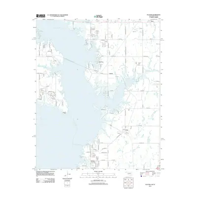
2012 Map of Platter
USGS Topo · Published 2012About this map
Lake Texoma dominates this landscape on the Oklahoma-Texas border, where the shoreline is defined by numerous inlets and points such as Washita Point and the waters of Cedar Bayou. The map reveals a high density of small family and community burial grounds, including Old Woodville Cem, Love Cem, and Franklin Cem, which serve as critical markers for genealogists tracing local families in the Mead and Platter areas. The residential patterns show a transition toward lakeside living, with clusters at Sand Point and Lakeside nestled between the larger reservoir and smaller tributaries like Alberta Cr and Sand Cr. These features, alongside the network of local roads such as Old Indian Trail Dr, reflect the integration of recreational water access with established rural settlements in Bryan County.
Find a feature on this map
127 named features on this map. Tap any name to fly to it.
Don’t see what you’re looking for? This feature index may not catch every label — zoom into the map to look around manually.
Map Details
Editions of this 2012 Platter Map
This is the sole edition of this map. No revisions or reprints were ever made.
Other maps of this area

1899 · Atoka
USGS Topo · 1:125,000

1900 · Atoka
USGS Topo · 1:125,000

1901 · Tishomingo
USGS Topo · 1:125,000

1901 · Denison
USGS Topo · 1:125,000

1954 · Sherman
USGS Topo · 1:250,000

1957 · Denison Dam
USGS Topo · 1:24,000

1957 · Ardmore
USGS Topo · 1:250,000

1958 · Durant
USGS Topo · 1:62,500

1958 · Denison Dam
USGS Topo · 1:62,500

1958 · Sherman
USGS Topo · 1:250,000