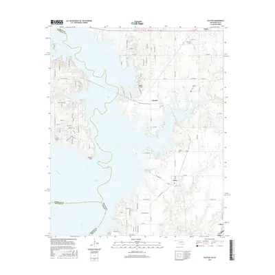
2016 Map of Platter
USGS Topo · Published 2016About this map
Lake Texoma dominates this landscape along the border of Oklahoma and Texas, where the reservoir reaches into the northern reaches of the Red River valley. This 2016 survey captures a region defined by recreational development and deep local roots, visible in the numerous burial sites like Old Woodville Cem and Platter Cem that remain on the higher ground. The map details the complex shoreline between Washita Point and Sand Point, where residential enclaves such as Lakeside and Mead sit amidst a network of rural roads and inlets like Catfish Bay. This geography reflects the 20th-century transformation of the river valley into a major water resource and recreational destination, while family-named landmarks like Willis Cem and Franklin Cem provide critical links for genealogists tracing the early settlement of Bryan and Marshall Counties.
Find a feature on this map
97 named features on this map. Tap any name to fly to it.
Don’t see what you’re looking for? This feature index may not catch every label — zoom into the map to look around manually.
Map Details
Editions of this 2016 Platter Map
This is the sole edition of this map. No revisions or reprints were ever made.
Other maps of this area

1899 · Atoka
USGS Topo · 1:125,000

1900 · Atoka
USGS Topo · 1:125,000

1901 · Tishomingo
USGS Topo · 1:125,000

1901 · Denison
USGS Topo · 1:125,000

1954 · Sherman
USGS Topo · 1:250,000

1957 · Denison Dam
USGS Topo · 1:24,000

1957 · Ardmore
USGS Topo · 1:250,000

1958 · Durant
USGS Topo · 1:62,500

1958 · Denison Dam
USGS Topo · 1:62,500

1958 · Sherman
USGS Topo · 1:250,000