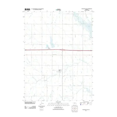
2011 Map of Pleasant Dale
USGS Topo · Published 2011About this map
Pleasant Dale sits at the center of this rural Seward County landscape, anchored by its small street grid along Main St and the Pleasant Dale Post Office. The surrounding terrain is defined by a dense network of drainage and water management, with South Branch Middle Creek and Culver Creek winding through sections of agricultural land toward the larger Pawnee Lake in the northeast. This 2011 survey documents a mix of traditional township roads, such as A Street Rd and Old Cheney Rd, alongside modern infrastructure like the Twin Lakes Dam-Site 13 Dam at Twin Lakes. Local history is preserved at the Pleasant Dale Cemetery, located just north of the town center. The map captures the quiet transition of this prairie landscape, where established drainage basins like Holmes Creek meet a structured grid of rural avenues and section lines.
Find a feature on this map
40 named features on this map. Tap any name to fly to it.
Don’t see what you’re looking for? This feature index may not catch every label — zoom into the map to look around manually.
Map Details
Editions of this 2011 Pleasant Dale Map
This is the sole edition of this map. No revisions or reprints were ever made.
Other maps of this area

1897 · Lincoln
USGS Topo · 1:125,000

1934 · Seward
USGS Topo · 1:48,000

1935 · Dorchester
USGS Topo · 1:48,000

1939 · Seward
USGS Topo · 1:62,500

1940 · Dorchester
USGS Topo · 1:62,500

1955 · Lincoln
USGS Topo · 1:250,000

1957 · Lincoln
USGS Topo · 1:250,000

1958 · Lincoln
USGS Topo · 1:250,000
1964 · Crete North
USGS Topo · 1:24,000
1964 · Dorchester
USGS Topo · 1:24,000