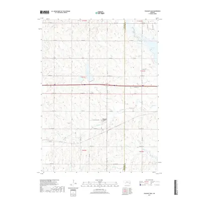
2017 Map of Pleasant Dale
USGS Topo · Published 2017About this map
Pleasant Dale serves as the central hub of this eastern Nebraska landscape, situated near the western edge of the Seward County and Lancaster County boundary. The area is defined by a dense network of watercourses and reservoirs, including the expansive Pawnee Lake in the northeast and the smaller Twin Lakes to its west. Local history is anchored by the Pleasant Dale Cem, located north of the town center along O Street Road.
Find a feature on this map
36 named features on this map. Tap any name to fly to it.
Don’t see what you’re looking for? This feature index may not catch every label — zoom into the map to look around manually.
Map Details
Editions of this 2017 Pleasant Dale Map
This is the sole edition of this map. No revisions or reprints were ever made.
Other maps of this area

1897 · Lincoln
USGS Topo · 1:125,000

1934 · Seward
USGS Topo · 1:48,000

1935 · Dorchester
USGS Topo · 1:48,000

1939 · Seward
USGS Topo · 1:62,500

1940 · Dorchester
USGS Topo · 1:62,500

1955 · Lincoln
USGS Topo · 1:250,000

1957 · Lincoln
USGS Topo · 1:250,000

1958 · Lincoln
USGS Topo · 1:250,000
1964 · Crete North
USGS Topo · 1:24,000
1964 · Dorchester
USGS Topo · 1:24,000